How Google Earth works
Most of us have been using one online mapping program or another for years now. They're a godsend for those of us who get lost within a 3-mile radius of our homes, and they're just plain fun for people who enjoy figuring out where stuff is. Click here to read more about how Google Earth Works.
Behind the scenes with Street View
Go behind the scenes with the Street View team, and learn about how we get our cars ready to hit the road.
Chandra: in the (Google) Sky
Astronomy is truly in a golden age. With a fleet of space-based observatories, including the Chandra X-ray Observatory, astronomers now have a suite of amazing tools to study the Universe. Simultaneously to this bonanza in astronomy has been the growth and expansion of the Internet. Think back to before 1990. The Internet was barely a rumor and there were no Great Observatories! But now people are taking advantage of these two seemingly separate advances to do some amazing things.
|
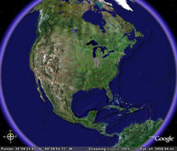
Google Earth how they do it
When you launch GoogleEarth on your computer, you start in outer space and you miraculously zoom in. You might see two unsuspecting guys walking across the Blue Wonder Bridge way off in Dresden, Germany.
But the folks at Google Earth remind us that you're not zooming in on just one picture. You're actually going through a succession - seamlessly - of closer and closer shots, making the transition from a NASA shuttle shot to a satellite shot to a photograph made from an airplane. So that's how they get such good close-up resolution. Click here to read more. Introducing the Street View Trike
The Street View trike lets us take pictures of places that are not accessible by car. Learn more about the trike athttp://maps.google.com/help/maps/stre...
Introducing the Street View Snowmobile
Street View is now on the ski slopes! You can now see the venues for the games and the world's first snowmobile Street View imagery on Google Maps.
Explore the Ocean with Google Maps & Catlin Seaview Survey
In September 2012 Google announced to the world that they were using our Catlin Seaview Survey "virtual dives" on the Google Streetview platform. This was the teaser video they used at the announcement.
|
